
 About 1.5 hours west of Moab the
landscape changes a bit. We are driving at a lower elevation than Arches so
we are seeing layers of earth not exposed in Arches. More
of the red broken strata has been exposed for more millennia than in Arches so
it looks like red drip sandcastles like we used to make at the beach. Billions of cubic feet of sand piles as far as the eye can see in all colors, from erosion at the base of
massive exposed buttes.
About 1.5 hours west of Moab the
landscape changes a bit. We are driving at a lower elevation than Arches so
we are seeing layers of earth not exposed in Arches. More
of the red broken strata has been exposed for more millennia than in Arches so
it looks like red drip sandcastles like we used to make at the beach. Billions of cubic feet of sand piles as far as the eye can see in all colors, from erosion at the base of
massive exposed buttes. 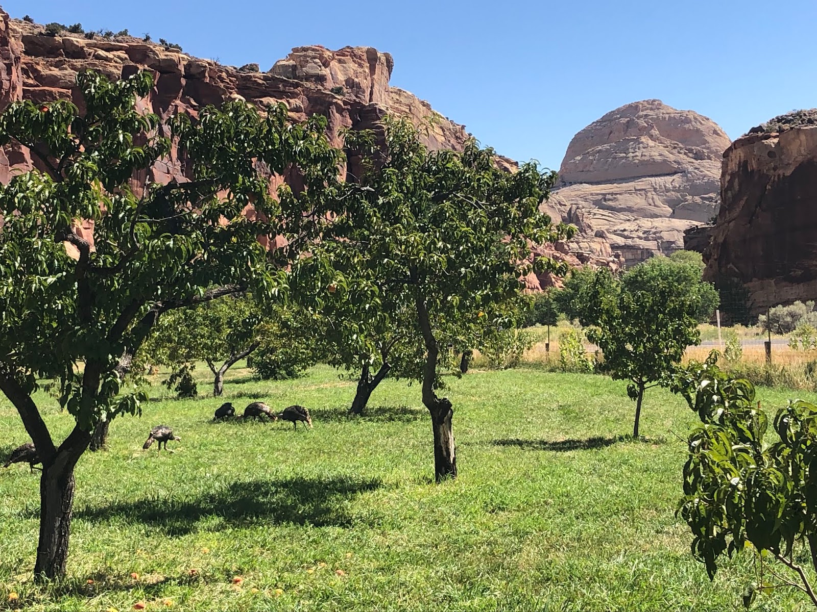 |
| Antique Orchards and Capital Dome in Background |
The tiny town of Fruita was settled by Mormon pioneers escaping religious persecution in the 1880’s. They subsisted by planting orchards which maintained about 10 Mormon families up to 1960. You can eat as much as you can pick while in the orchards but have to pay $1 a pound for what you take away. We picked 20 pounds of apples and peaches! The park staff maintain these orchards using heritage techniques including the old time irrigation drains. Much of the fruit are heirloom varieties dating back to the late 1800's.
We dry camped about 15 miles from Fruita down route 12 off in Singletree Campground. If we had known, there are areas just west of the first visitor center( going west on 24) where campers pulled off the road into natural unimproved areas and boondocked (camped for free). There are lots of boondock areas out here.
 |
| A Reef Like Rock Structure |
Some say the reef was named by early explorers (white man did not explore here till mid 1800’s) because it was a natural barrier in the landscape, others say it was because there are areas that look reef like. See Debra sitting at the bottom of such a "reef".
 |
| Waterpocket Fold in Capital Reef |
The reef surrounds a unique long wrinkle in the earth known as the Waterpocket Fold. The elevation here is from 3,800 to 8,900 feet above sea level and this fold captures what little rain it gets.
 |
| Cohab Trail |
 We hiked the Cohab Canyon Trail which got it’s name from the
legend that the Mormon's escaped into these parts when hiding out from
the Fed’s raids trying to shut them down. It is
only 3.2 miles but the first third mile is
440 feet up.
We hiked the Cohab Canyon Trail which got it’s name from the
legend that the Mormon's escaped into these parts when hiding out from
the Fed’s raids trying to shut them down. It is
only 3.2 miles but the first third mile is
440 feet up.  Hiking along the valley river wash was beautiful. Does something look out of
place in this red and white rocky landscape?
How did those black lava rocks get there? About 25 million years ago volcanic activity far
west of here spewed lava rocks which were transported here by ancient river and
sea flows.
Hiking along the valley river wash was beautiful. Does something look out of
place in this red and white rocky landscape?
How did those black lava rocks get there? About 25 million years ago volcanic activity far
west of here spewed lava rocks which were transported here by ancient river and
sea flows. Today's Hike: 4.4 miles (880 feet elevation change up and down)
No comments:
Post a Comment